Boumerdès (Boumerdas)
Boumerdès is a seaside city located in the north of Algeria about 50 km east of Algiers and 50 km west of Tizi Ouzou. During French occupation of Algeria, the city was named Rocher Noir, translated from French as Black Rock.
It is the capital city of Wilaya (district) of Boumerdès. The 6.8 Mw Boumerdès earthquake shook northern Algeria with a maximum Mercalli intensity of X (Extreme). More than 2,200 people were killed, over 10,000 were injured, and a moderate tsunami sank boats at the Balearic Islands. The city became the capital of the province, having the same name, according to the administrative division in 1984.
The city is famous as a scientific center, including a number of national institutes and the University of M'hamed Bouguerra. The institutes include l'Institut Algérien du Pétrole (the Algerian Petroleum Institute IAP), Faculté des Hydrocarbures et de la Chimie (Faculty of Hydrocarbons and Chemistry FHC), l'Institut National d'Électricité et d'Électronique (The National Institute for Electricity and Electronics INELEC), l'Institut National de Génie mécanique (The National Institute of Mechanical Engineering ENGM), l'Institut National des Industries légères (The National Institute for Light Industries INIL).
The city is also known as an industrial center containing the headquarters of Sonatrach Exploration, l'Entreprise Nationale de Géophysique (ENAGEO), and le Centre de Recherches et de Développement (Research and Development Center for Sonatrach CRD).
The neighbourhoods of Boumerdès are:
Map - Boumerdès (Boumerdas)
Map
Country - Algeria
 |
|
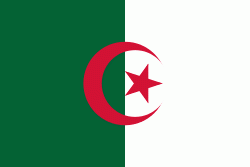
| Flag of Algeria | |
Algeria produced and is linked to many civilizations, empires and dynasties, including ancient Numidians, Phoenicians, Carthaginians, Romans, Vandals, Byzantines, Umayyads, Abbasids, Rustamids, Idrisids, Aghlabids, Fatimids, Zirids, Hammadids, Almoravids, Almohads, Zayyanids, Spaniards, Ottomans and the French colonial empire, with the latter expanded into its present-boundaries. After 132 years of being part of France, tensions between France and the local Algerian populace led to the start of the Algerian War which concluded with Algeria obtaining its independence on 5 July 1962 with the establishment of the People's Democratic Republic on 20 September of that year.
Currency / Language
| ISO | Currency | Symbol | Significant figures |
|---|---|---|---|
| DZD | Algerian dinar | دج | 2 |
| ISO | Language |
|---|---|
| AR | Arabic language |


